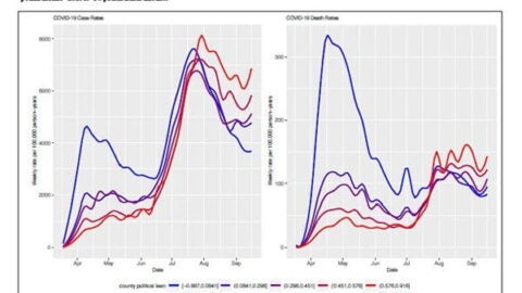
Harvard Pop Center Working Paper cited in New York Times; contributes race and ethnicity data on years of potential life lost by younger American Black and Latinos due to COVID-19
A Harvard Pop Center Working Paper (now published in PLOS Medicine) is referenced in a piece in The New York Times that explores the potential years of life lost in the United States due to COVID-19.
Photos (left): by Diana Simumpande on Unsplash;…